

Bathymetic Survey by Sonar
Mineral Connext
Service Information
Solutions
Technologies and Services
Bathymetic Survey by Sonar
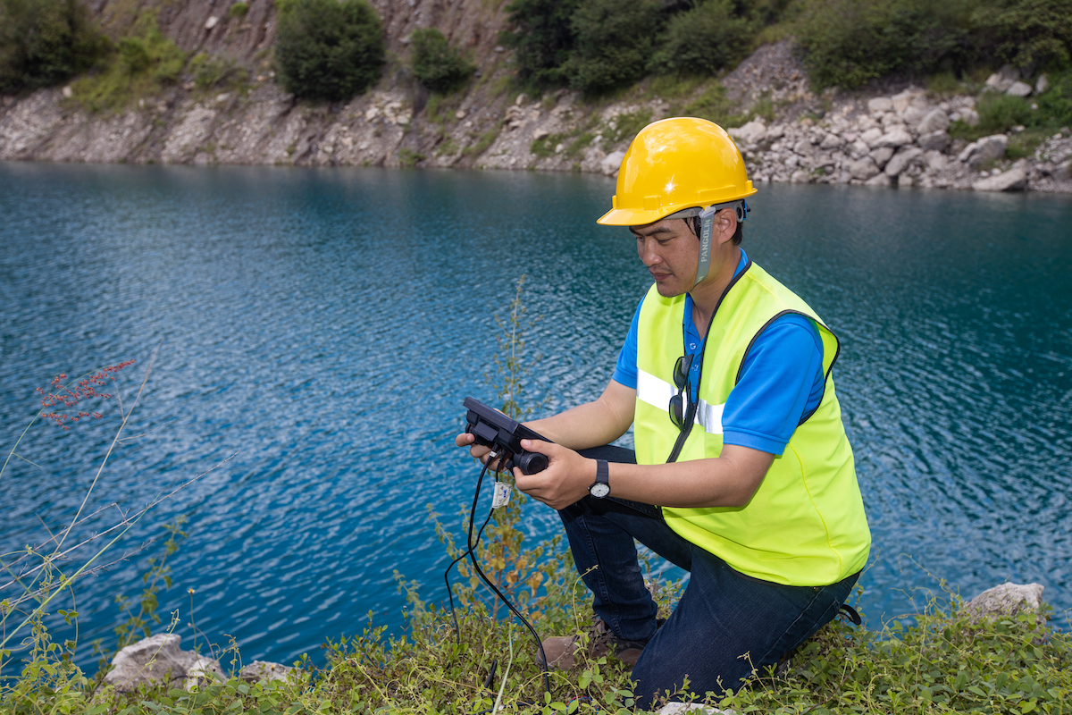
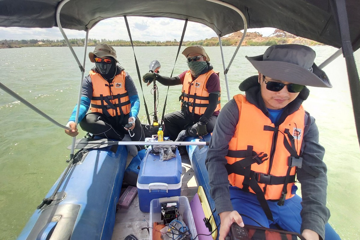
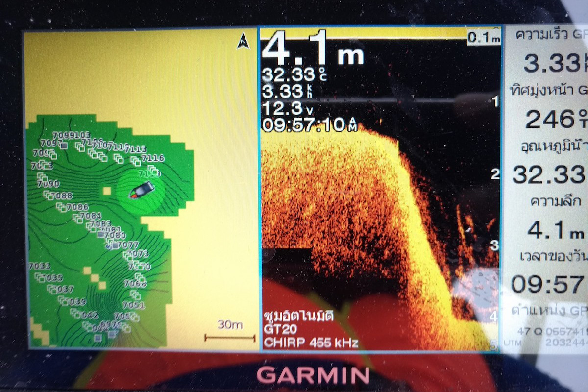
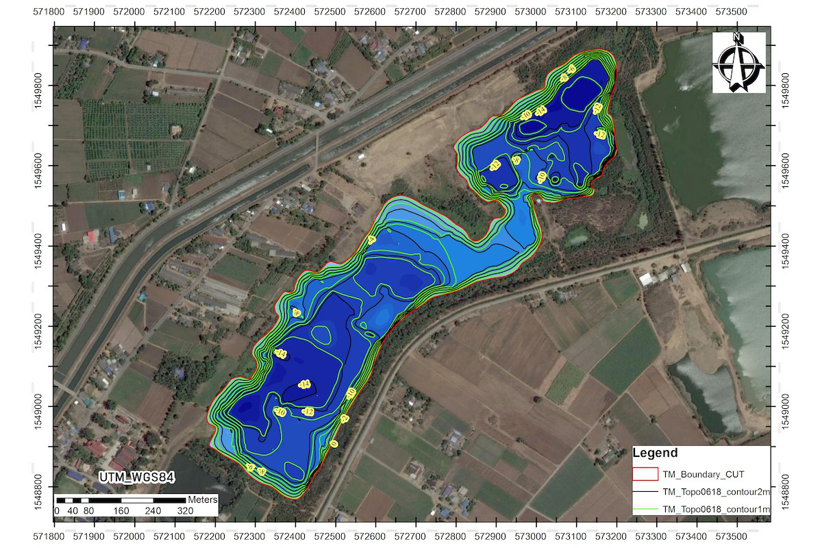
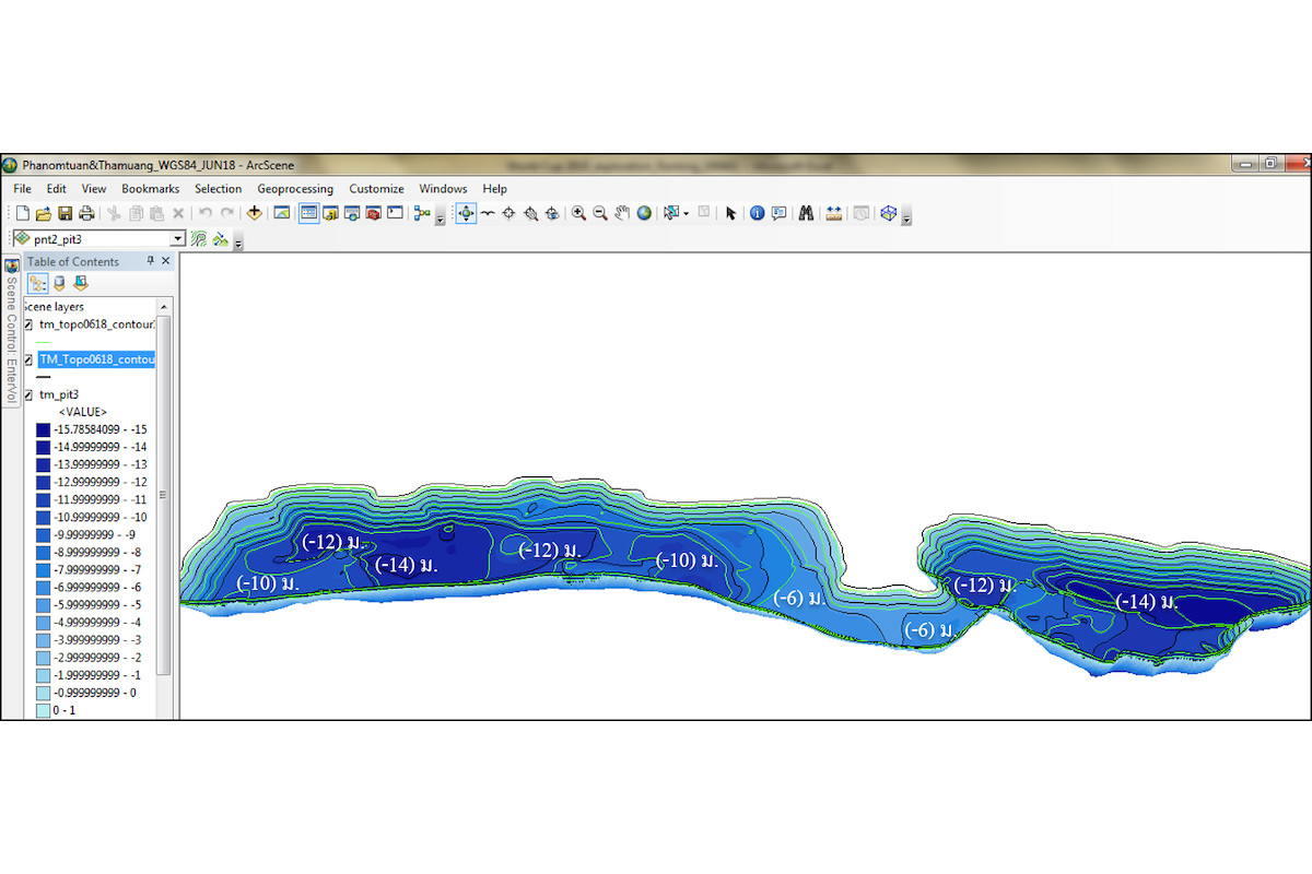
We provide bathymetric survey, water depth, and pit depth by Sonar (sound navigation and ranging) processed with ArcGIS for underwater terrain mapping.
We have advanced technology and more than 10 years expertise and experiences in sand pit and quarry survey for creating underwater mapping.
Our services are
- Bathymetric survey to view pit conditions, mapping underwater depth, and calculate volume and water storage capacity.
- Sandpit survey to plan sand production.
- Sand reserve evaluation service by applying underwater depth data and sandpit data to calculate the residual of sand volume.
Our services are suitable for
- Mining industry, construction industry, and Topographic mapping.
Additional documents
Cookie Policy
We use Cookies to improve performance of our website in order to deliver visitors the best possible experience. You can learn more about Cookies at